Top
3D Laser scanning Company in INDIA.
Why Choose Testronix for Your Next Complex 3D Modeling Project?

Testronix Engineering’s commitment to quality, precision, and innovation has positioned us as a go-to partner for complex 3D modeling needs. With our cutting-edge technology, industry expertise, and focus on customer collaboration, we simplify the process of turning intricate point cloud data into usable, detailed models.

Our experience across industries and ability to handle large-scale, high-detail projects makes us ideally suited to take on complex geometries and make them manageable for our clients.

Why 3D Models Aren’t Matching As-Built Reality: Addressing Data Accuracy Issues and Best Practices

December, 2024
Posted by: Admin
Category: Data Accuracy

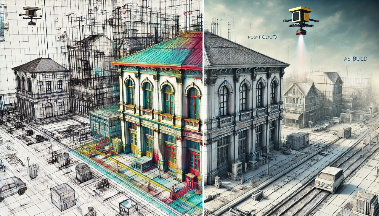
In the age of digitization and advanced engineering, 3D modeling has become a cornerstone for planning, design, and management across various industries. However, a recurring challenge has surfaced: discrepancies between 3D models and the actual as-built reality. These mismatches can lead to inefficiencies, increased costs, and project delays. To address these issues, it is vital to understand the root causes, explore best practices, and leverage cutting-edge technologies like laser scanning. Here, we delve into why 3D models often fail to reflect reality accurately and how Testronix Engineering is addressing these challenges.

Common Causes of Discrepancies in 3D Models

  • Human Error During Manual Surveys: Manual measurements are prone to errors due to limitations in human accuracy, environmental constraints, and the complexities of capturing intricate structures. These inaccuracies compound as the data is transferred into 3D modeling software.
  • Aging Infrastructure: Many facilities, especially in industries like oil and gas or manufacturing, operate with aging infrastructure. Over time, modifications are made to structures that may not be adequately documented, causing legacy models to diverge significantly from reality.
  • Inconsistent Data Capture: Incomplete or inconsistent data capture during the initial survey stage can create significant gaps in 3D models. Factors like poor lighting, obstructions, or suboptimal positioning of scanning devices contribute to this issue.
  • Limited Resolution in Point Cloud Data: Low-resolution scans fail to capture the fine details of complex geometries, leading to oversimplified models that do not account for small but critical elements.
  • Software Limitations: Some software tools may lack advanced algorithms to interpret point cloud data accurately, resulting in a loss of fidelity during the modeling process.
  • Misaligned Collaboration: When multiple teams handle data collection and modeling without clear standards, it can lead to inconsistent results. Miscommunication about design updates also contributes to discrepancies.

Best Practices for Ensuring Accurate 3D Models

  • Adopt High-Precision Data Capture Techniques: Use advanced laser scanning technologies that can generate high-resolution point clouds. Devices like LiDAR scanners ensure comprehensive and precise data collection.
  • Conduct Multiple Scans for Validation: Multiple scans from different angles and positions help eliminate blind spots and ensure no critical details are missed. Merging these scans creates a robust dataset for modeling.
  • Implement Clear Documentation Standards: Maintain rigorous documentation practices for both historical and newly captured data. Standards should include metadata, file naming conventions, and detailed notes on site conditions.
  • Engage Cross-Functional Teams: Foster collaboration between surveyors, modelers, and project stakeholders. This alignment ensures that any potential issues are addressed early in the process.
  • Regularly Update Models: Treat 3D models as living documents. Schedule regular updates to incorporate new modifications and ensure alignment with current site conditions.
  • Utilize Quality Assurance Tools: Implement validation checks by comparing the 3D model against the original point cloud data. Advanced software tools can highlight deviations, enabling corrections before project implementation.
  • Invest in Skilled Personnel: Hire and train personnel with expertise in laser scanning, data processing, and 3D modeling. Skilled professionals can mitigate errors and enhance overall project outcomes.

The Role of Laser Scanning Technology in Bridging the Gap

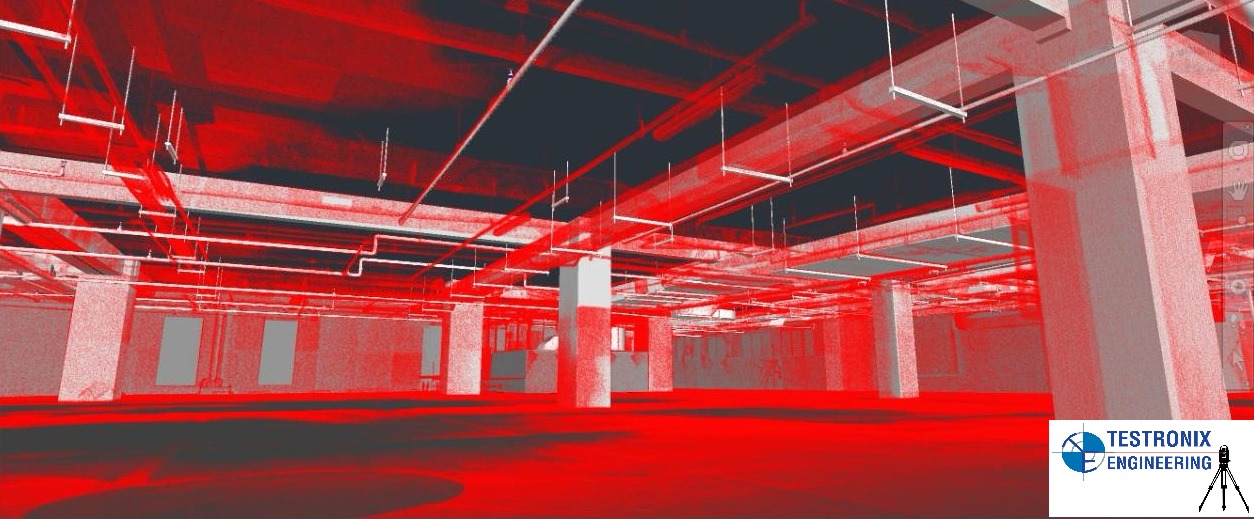
Laser scanning technology has revolutionized the process of capturing as-built conditions. By emitting laser beams to measure distances, these scanners create highly accurate point clouds that serve as the foundation for 3D modeling. Unlike traditional methods, laser scanning captures millions of data points in a fraction of the time, ensuring unmatched precision and completeness.

Advantages of Laser Scanning:

  • High Accuracy: With precision down to millimeters, laser scanners capture the exact dimensions and contours of objects and structures.
  • Speed and Efficiency: Scanning large areas or complex geometries takes hours instead of days, significantly reducing survey times.
  • Comprehensive Coverage: Laser scanners can access hard-to-reach areas and capture data from multiple angles, leaving no blind spots.
  • Digital Archiving: The point clouds serve as a digital record, preserving the as-built conditions for future reference and updates.

Case Study: Tackling Data Challenges in a Large-Scale Project

Testronix recently completed a large-scale scanning project for a petrochemical plant. The project involved capturing terabytes of point cloud data for detailed 3D modeling. Here’s how we managed the data effectively:

  • Implemented Redundant Backups: Data was backed up in real-time to local storage and cloud servers, ensuring minimal risk of loss.
  • Optimized Workflow: Using centralized data storage, all team members had access to the latest files, eliminating redundant workflows.
  • Ensured Security: Encryption protocols and access controls protected sensitive project data from unauthorized access.
  • Streamlined Collaboration: With real-time collaboration tools, stakeholders across geographies could access and review data without delays.
  • The result? The project was delivered on time, with zero data loss and minimal downtime, reinforcing Testronix’s commitment to reliability and efficiency.

How Testronix Engineering Ensures As-Built Accuracy

Testronix Engineering has emerged as a leader in the field of laser scanning and 3D modeling. With a focus on precision, efficiency, and client satisfaction, the company leverages state-of-the-art technology to address the challenges of as-built documentation.

Key Solutions Offered by Testronix:

  • Advanced Laser Scanning Tools: Testronix employs high-resolution laser scanners, including LiDAR systems, to capture detailed as-built conditions. These tools ensure that even the most intricate features of a structure are accurately recorded.
  • Seamless Point Cloud Processing: Using industry-leading software, Testronix processes raw point cloud data into actionable insights. This involves noise reduction, alignment of multiple scans, and the generation of clean, accurate datasets for modeling.
  • 3D Model Verification: Before delivering a 3D model to clients, Testronix conducts rigorous quality checks. By overlaying the model onto the original point cloud, discrepancies are identified and resolved to ensure fidelity.
  • Customized Solutions: Every project is unique. Testronix tailors its approach based on specific industry needs, whether it’s for petrochemical plants, infrastructure, or manufacturing facilities.
  • Ongoing Support: Beyond project delivery, Testronix offers support services, including updates to 3D models and guidance on integrating models into workflows.

Real-World Applications of Testronix’s Expertise

  • Industrial Plant Renovations: Testronix has helped numerous clients renovate aging industrial plants by providing accurate as-built models. These models ensure that new installations align perfectly with existing conditions, reducing rework and downtime.
  • Infrastructure Upgrades: For large infrastructure projects, accurate 3D models are critical. Testronix’s laser scanning capabilities have enabled seamless upgrades to bridges, tunnels, and rail networks.
  • BIM Integration: By integrating 3D models with Building Information Modeling (BIM) platforms, Testronix enhances collaboration and decision-making across project teams.

Author :Admin

Conclusion

The gap between 3D models and as-built reality is not an insurmountable challenge. By addressing the root causes of discrepancies and adopting best practices, industries can achieve models that truly reflect on-site conditions. With laser scanning technology and expert services from leaders like Testronix Engineering, the path to accurate, reliable, and actionable as-built documentation is clear. Whether it’s reducing project risks or enhancing operational efficiency, the benefits of closing the gap are undeniable.

Call Us
Mobile: +91 98497 71676
Visit Us
1-407, Muthoot Finance Building, Chandanagar, Hyderabad, Telangana -500050